Naina Peak
#7von 9 Orten zum Besuchen in NainitalNainital, Uttarakhand
Auch bekannt als China Peak · Cheena Peak
Kurz gesagt
Öffnungszeiten: 06:00–17:00. Der Eintritt ist kostenlos. Plane 5 hrs ein. Beste Zeit: 07:00 – 08:00 start.
Aktualisiert am · Erstellt von Traveliac, KI-unterstützt · 4 Min. Lesezeit
- Öffnungszeiten
- 06:00–17:00
- Eintrittspreis
- Kostenlos
- Benötigte Zeit
- 5 hrs
- Beste Tageszeit
- 07:00 – 08:00 start
- Beste Monate
- Mar – Jun, Sep – Nov
- Adresse
- Trailhead near Mallital, Nainital, Uttarakhand 263001
Über Naina Peak
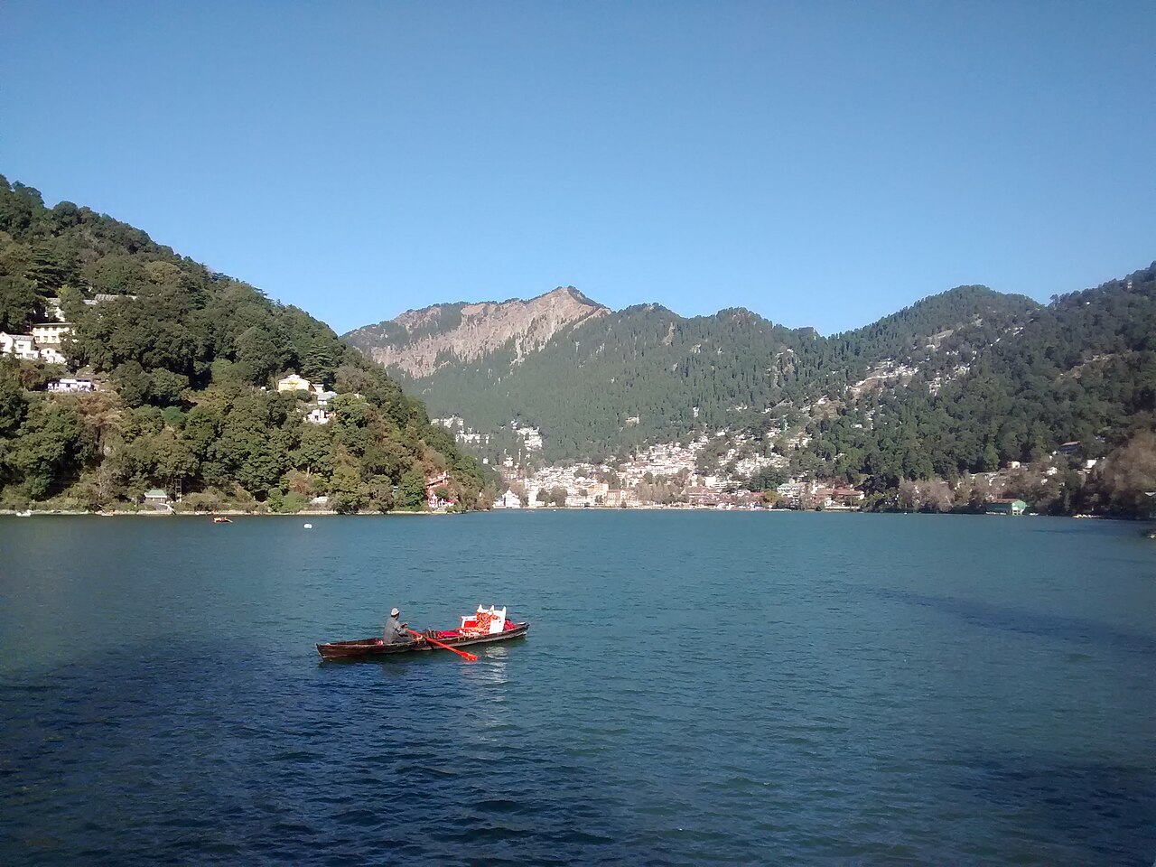
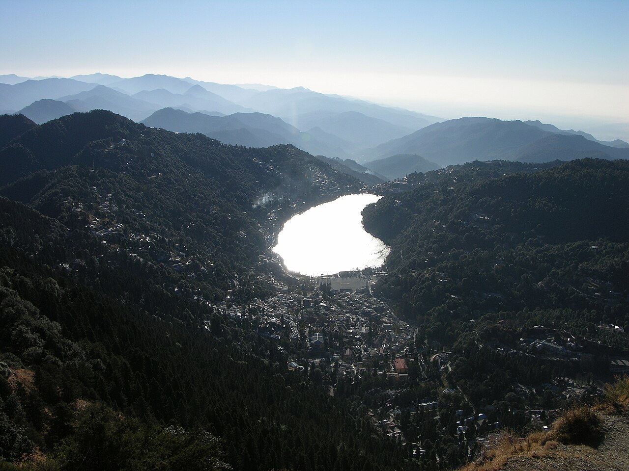
Naina Peak rises to 2,615 metres above Nainital, the highest point in the town's immediate hills and the summit that the Snow View ropeway climbs only partway toward. The trail runs roughly 6 kilometres from Mallital through progressively denser deodar, cypress, and rhododendron forest, gaining nearly 700 metres of elevation over a two-to-three-hour ascent that most guidebooks rate as moderate rather than difficult, provided walkers are reasonably fit and unhurried. The summit is the only point around Nainital from which Nanda Devi, Trishul, and Nanda Kot — three of the Kumaon Himalaya's major peaks — are visible together on a clear day, alongside a bird's-eye view down onto the full crescent of Naini Lake and the town wrapped around it.
Beste Tageszeit: 07:00 – 08:00 start. To reach the 2,615-metre summit before midday cloud typically builds over the distant Himalayan skyline.
Öffnungszeiten von Naina Peak
- Öffnungszeiten
- 06:00–17:00
Mon–Sun 06:00–17:00 - Geschlossen an
- Täglich geöffnet
Gut zu wissen: The trail can be muddy in the July–September monsoon and may carry light snow in January; winter ascents should start earlier to allow for a daylight descent.
Öffnungszeiten zusammengestellt aus uttarakhandtourism.gov.in und öffentlichen Quellen, zuletzt aktualisiert am . Sie können sich ohne Vorankündigung ändern — vor der Reise bitte bestätigen. Wie wir diese Reiseführer schreiben
Eintrittspreis für Naina Peak
| Ticket | Preis |
|---|---|
| Indische Besucher | Kostenlos |
| Ausländische Besucher | Kostenlos |
| Kinder | Kostenlos |
| Kamera | Kostenlos |
No entry fee. Horse and pony hire from Mallital for part of the ascent is negotiated separately, typically in the same ₹500–₹800 range as other Nainital viewpoint treks as of 2026 — agree the price before setting off.
Preise zusammengestellt aus uttarakhandtourism.gov.in und öffentlichen Quellen, zuletzt aktualisiert am . Sie können sich ohne Vorankündigung ändern — vor der Reise bitte bestätigen. Wie wir diese Reiseführer schreiben
Beste Reisezeit für Naina Peak
- Quiet
- Moderate
06:00 – 08:00
Dawn StartersBest time to go
Serious trekkers only; trail is quiet and coolest for the steep initial climb.
Quiet08:00 – 11:00
Morning Ascent
Main window for day-trekkers heading up; summit views are clearest before midday cloud typically develops.
Moderate11:00 – 14:00
Midday Descent Traffic
Mix of ascending latecomers and descending early starters; summit visibility often degrades from cloud buildup.
Moderate14:00 – 16:00
Late Descent
Trail traffic thins; trekkers should aim to be off the mountain before dusk given the lack of trail lighting.
Quiet
Geschichte von Naina Peak
Naina Peak's original name, China Peak or Cheena Peak, dates to the colonial period and is of uncertain precise origin, though it long preceded any political dispute with China. Following the 1962 Sino-Indian War, the Indian government renamed the summit Naina Peak, replacing the earlier name with one tied to the town's presiding goddess, Naina Devi, in a period when several India-China border-region place names with 'China' or 'Cheena' references were similarly renamed.
The trail itself follows old forest and bridle paths that predate organised trekking tourism, originally used by foresters and villagers moving through the Ayarpata-Naina ridge system, and it remains largely unpaved and unmarked beyond periodic forest department signage.
Regeln & Etikette in Naina Peak
There is no ticket counter or gate, but the trail passes through reserved forest department land, so visitors should stay on the established path, avoid lighting fires, and carry out all litter — the forest here is dry and prone to fire risk in the pre-monsoon months of April and May. A local guide is advisable for first-time trekkers since the upper trail has multiple forks that are not consistently signposted.
Mobile network coverage becomes unreliable or absent above the mid-point of the climb; trekkers should inform someone of their planned return time and carry a paper map or offline GPS track rather than relying on a live signal. Weather can change quickly at this elevation — a waterproof layer is worth carrying even on a clear morning.
Tipps für den Besuch von Naina Peak
- 1
Start early — reaching the summit before 10:00 gives the best chance of an unobstructed Himalayan view before afternoon cloud typically builds, and it also avoids descending the forested trail in fading light, since there is no lighting along the route. Carry adequate water; there are no reliable shops along the 6-kilometre trail, unlike the shorter Tiffin Top route.
- 2
For those short on time or fitness, the Snow View ropeway covers the lower portion of the same ridge and can be combined with a shorter final push to the summit rather than the full 6-kilometre trek from Mallital, though this still requires a genuine uphill walk beyond the ropeway station. Rhododendron blooms in March and April add a distinct seasonal layer to the forest sections of the climb.
Anreise nach Naina Peak
Wir haben die genaue Position von Naina Peak noch nicht erfasst; die Karte zeigt die anderen Orte aus unserem Nainital-Reiseführer. Nutze die Adresse unten oder den Routenlink.
Trailhead near Mallital, Nainital, Uttarakhand 263001Route in Google Maps
Ab Mall Road, Mallital
1 km · 15 min walk to trailhead, then 2–3 hours trek
Free (walk to trailhead); horse hire ₹500–₹800 for part of the ascent.
Ab Kathgodam Railway Station
₹900–₹1,20037 km · 80–95 min
Shared taxi to Mallital).
Ab Pantnagar Airport (PGH)
₹1,800–₹2,50073 km · 2.5 hours
Prepaid taxi).
Nächster Flughafen
Ab Pantnagar Airport (PGH)
73 km, approximately 2.5 hours by road.
Nächster Bahnhof
Ab Kathgodam Railway Station
37 km, approximately 1.5 hours by road.
Häufige Fragen zu Naina Peak
How high is Naina Peak?
2,615 metres above sea level, the highest point in Nainital's immediate hills.
Why was Naina Peak previously called China Peak?
The colonial-era name China Peak, or Cheena Peak, was replaced with Naina Peak by the Indian government following the 1962 Sino-Indian War, part of a broader renaming of India-China border-region place names in that period.
How long does the trek to Naina Peak take?
Around 2 to 3 hours for the roughly 6-kilometre ascent from Mallital, with a shorter descent; the trail is rated moderate rather than difficult.
Can the Snow View ropeway be used to shorten the Naina Peak climb?
Yes. The ropeway covers the lower portion of the same ridge, letting trekkers combine it with a shorter final push to the summit instead of the full 6-kilometre walk from Mallital.
Mit KI-Unterstützung aus offiziellen Quellen und öffentlichen Aufzeichnungen erstellt und erst nach den Prüfungen veröffentlicht, die beschrieben sind unter Wie wir diese Reiseführer schreiben. Niemand von Traveliac war persönlich vor Ort. Zuletzt aktualisiert am . Wie wir Orte bewerten und prüfen