
Vaigai Dam
#10Madurai में घूमने की 10 जगहों में सेMadurai, Tamil Nadu
इन्हें भी कहा जाता है Vaigai Reservoir
संक्षिप्त उत्तर
खुलने का समय: 09:00–18:00. प्रवेश शुल्क: ₹20. 1.5 hrs का समय रखें। सबसे अच्छा समय: 16:00–17:30।
अपडेट किया गया · तैयार किया गया Traveliac, AI की मदद से · 4 मिनट का पठन
- खुलने का समय
- 09:00–18:00
- 09:00–18:00 daily (garden and viewing areas)
- प्रवेश शुल्क
- ₹20
- टिकट शुरू
- आवश्यक समय
- 1.5 hrs
- दिन का सबसे अच्छा समय
- 16:00–17:30
- सबसे अच्छे महीने
- Oct – Mar
- पता
- Andipatti Taluk, Theni district border, Tamil Nadu (approximately 70 km southwest of Madurai city, on the Madurai–Theni road)
Vaigai Dam के बारे में
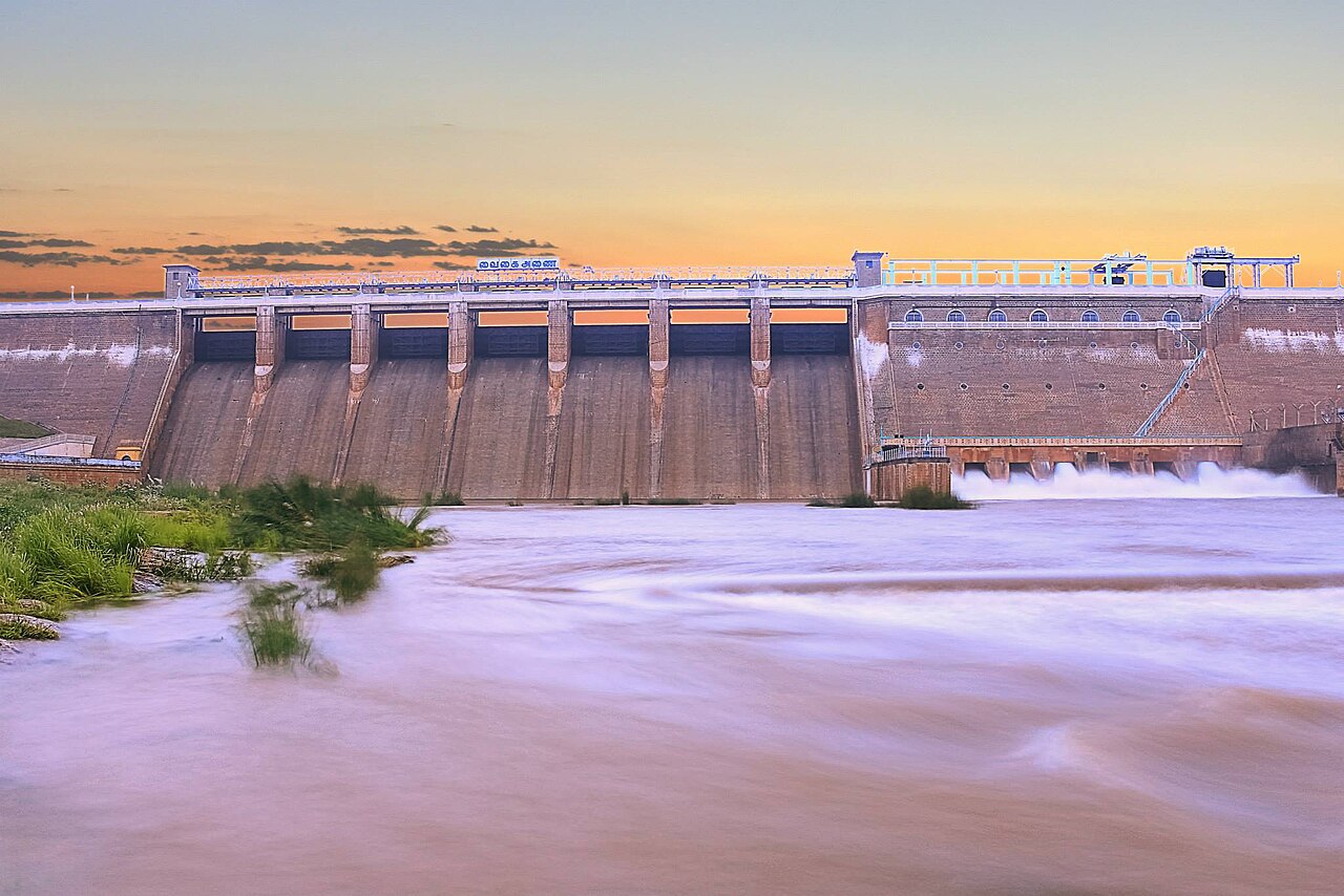
Vaigai Dam sits roughly 70 kilometres southwest of Madurai near the Theni district border, a masonry and earthen gravity dam completed in 1959 across the same Vaigai River that runs, considerably tamed by this point in its course, through the city itself. This is the single largest engineered check on a river whose downstream behaviour — including whether the Vandiyur Teppakulam tank in Madurai has enough water pumped through its feeder channel to be flooded for festival use — is directly governed by decisions made about how much water this dam releases and when. The dam itself is a working piece of state irrigation infrastructure rather than a monument, but the Tamil Nadu government has developed manicured terraced gardens along its embankment in a style recognisably borrowed from the Mughal-influenced Brindavan Gardens template used at several South Indian dam sites, giving the location a dual identity as both hydraulic engineering and weekend recreation ground for Madurai families.
दिन का सबसे अच्छा समय: 16:00–17:30। For the cooler late-afternoon garden walk and the best light on the reservoir's water surface, particularly in the November–January high-water season.
Vaigai Dam का समय
- खुलने का समय
- 09:00–18:00
Mon–Sun 09:00–18:00 - 09:00–18:00 daily (garden and viewing areas)
- बंद रहता है
- हर दिन खुला
जानना ज़रूरी: Water levels and the dam's visual drama vary substantially by season — the reservoir is at its fullest and most impressive following the northeast monsoon (November–January), while by the pre-monsoon months of May–June water levels can drop to a fraction of capacity, exposing large stretches of the reservoir bed. Boating operations are typically suspended when water levels fall below a safe operating threshold.
खुलने का समय tamilnadutourism.tn.gov.in और सार्वजनिक रिकॉर्ड से तैयार किया गया, आख़िरी बार को अपडेट किया गया. ये बिना सूचना के बदल सकते हैं — यात्रा से पहले पुष्टि करें। हम ये गाइड कैसे लिखते हैं
Vaigai Dam टिकट मूल्य
| टिकट | कीमत |
|---|---|
| भारतीय आगंतुक | ₹20 |
| विदेशी आगंतुक | ₹20 |
| बच्चे | ₹10 |
| कैमरा | निःशुल्क |
Entry fee applies to the ornamental garden area maintained alongside the dam; the dam structure and viewing points themselves are free to approach. Boating, where operated seasonally by the Tamil Nadu Tourism Development Corporation, is charged separately at approximately ₹30–₹60 per person depending on boat type.
कीमतें tamilnadutourism.tn.gov.in और सार्वजनिक रिकॉर्ड से तैयार किया गया, आख़िरी बार को अपडेट किया गया. ये बिना सूचना के बदल सकते हैं — यात्रा से पहले पुष्टि करें। हम ये गाइड कैसे लिखते हैं
Vaigai Dam घूमने का सही समय
- Quiet
- Moderate
09:00–12:00
Morning ArrivalBest time to go
Early travellers making the 70 km drive from Madurai arrive in this window. Garden areas and viewing points are uncrowded; boating (when operating) has minimal queue.
Quiet12:00–15:00
Midday
Heat discourages extended garden walks. Reservoir viewing points remain accessible but shade is limited across most of the embankment.
Quiet15:00–17:30
Afternoon Peak
Local families and weekend day-trippers from Madurai concentrate in this window, drawn by cooler temperatures and better light on the water surface.
Moderate17:30–18:00
Pre-Closure
Visitor numbers thin as closing time approaches; the return drive to Madurai should begin with enough daylight margin given the rural road conditions after dark.
Quiet
Vaigai Dam का इतिहास
Construction on Vaigai Dam began in the 1950s as part of a broader post-independence push to expand irrigated agriculture across the historically drought-vulnerable Vaigai basin, with the completed structure impounding water from 1959 onward to serve the paddy and other cultivation across Madurai, Sivaganga, and Ramanathapuram districts downstream. The dam's construction fundamentally altered the Vaigai's seasonal flow character in Madurai city itself: where the river historically carried monsoon flood pulses directly through the city, the dam's regulated release schedule now determines how much water reaches Madurai in any given month, a factor directly implicated in the increasingly unreliable water levels observed at both the river itself and dependent features like the Vandiyur Teppakulam tank in recent decades. The ornamental garden development along the embankment was added in subsequent decades as a secondary tourism function, following a broader mid-20th-century Tamil Nadu pattern of pairing irrigation infrastructure with public recreational gardens, a combination that reflects the era's confidence in large-scale civil engineering as simultaneously utilitarian and aspirationally beautiful.
Vaigai Dam के नियम व शिष्टाचार
The dam structure itself, as active water-management infrastructure under Public Works Department jurisdiction, restricts public access to designated viewing points and the embankment walkway; visitors should not attempt to cross onto restricted maintenance sections regardless of how accessible they may appear, since these areas carry genuine operational hazards including sluice-gate machinery. The garden area operates under standard park etiquette — no littering, no plucking of ornamental plantings, and reasonable supervision of children near the water's edge given the absence of extensive barrier fencing at several embankment sections. Boating, where operated, follows standard life-jacket requirements enforced by TTDC staff; do not board without one regardless of swimming ability, since reservoir water depth and underwater structure near the dam wall are not uniform or intuitive.
Vaigai Dam जाने के लिए टिप्स
- 1
Treat this specifically as a full or near-full day trip rather than a half-day add-on, given the 70-kilometre one-way distance and the fact that the drive itself, through agricultural countryside and past the foothills of the Western Ghats spur separating Madurai from Theni district, is a substantial part of the appeal. Confirm current water levels before travelling if the reservoir's visual impact is your primary motivation — the difference between a November visit with the dam at capacity and a May visit with large exposed mudflats along the reservoir bed is considerable, and TTDC or local hotel staff in Madurai can usually give a same-week assessment. Boating availability is genuinely seasonal and weather-dependent rather than a guaranteed activity; do not build an itinerary around it without a same-day confirmation. Pack food and water for the drive, since roadside options along the Madurai–Theni road, while present, are inconsistent in quality and hygiene standards compared to established city restaurants. The dam is sometimes combined with a longer excursion toward Kodaikanal, since the road toward the hill station passes reasonably close to the Theni-district approach, though this requires careful route planning rather than a casual detour given the total combined distance.
Vaigai Dam कैसे पहुंचें
लाल तारा Vaigai Dam है. विवरण के लिए पिन पर टैप करें।
Andipatti Taluk, Theni district border, Tamil Nadu (approximately 70 km southwest of Madurai city, on the Madurai–Theni road)Google Maps में दिशा-निर्देश
Meenakshi Amman Temple से
₹1,800–₹2,50068 km · 85–100 min
Round trip including waiting time
Madurai Junction Railway Station से
₹1,800–₹2,50070 km · 90–105 min
Round trip including waiting time
Madurai Airport से
₹2,000–₹2,70078 km · 100–115 min
नज़दीकी हवाई अड्डा
Madurai Airport (IXM) से
78 km, 1 hour 45 minutes
नज़दीकी रेलवे स्टेशन
Madurai Junction Railway Station से
70 km, 1 hour 30 minutes
Vaigai Dam — अक्सर पूछे जाने वाले सवाल
Is Vaigai Dam worth the 70-kilometre drive from Madurai?
It depends heavily on season and expectations. During and after the November–January high-water period, the reservoir and gardens make for a substantial, scenic day trip. In the dry pre-monsoon months (April–June), water levels can drop considerably, exposing reservoir bed and reducing the visual payoff. Confirm current conditions before committing a full day to the trip.
How does this dam relate to Madurai's own Vaigai River and the Vandiyur Teppakulam tank?
Vaigai Dam regulates the river's flow well upstream of Madurai city, and its release schedule directly affects how much water reaches the city — including whether there is sufficient flow to feed the channel supplying Vandiyur Mariamman Teppakulam ahead of its annual Float Festival.
Is boating available and is it safe?
Boating is operated seasonally by the Tamil Nadu Tourism Development Corporation and is suspended when water levels fall below a safe operating threshold, so it should not be assumed as a guaranteed activity. When operating, life jackets are mandatory and enforced by TTDC staff.
Can Vaigai Dam be combined with other day trips from Madurai?
It is sometimes combined with a longer route toward Kodaikanal, since the approach through Theni district runs in a broadly similar direction, though this requires deliberate route planning given the combined distance rather than functioning as a casual add-on stop.
आधिकारिक स्रोतों और सार्वजनिक रिकॉर्ड से AI की मदद से तैयार किया गया, और इसमें दी गई जांच के बाद ही प्रकाशित किया गया हम ये गाइड कैसे लिखते हैं. Traveliac से किसी ने भी इस जगह का दौरा नहीं किया है। आख़िरी बार को अपडेट किया गया। हम जगहों को कैसे रैंक और जांच करते हैं
Vaigai Dam के पास घूमने की जगहें
दूरियां हमारे मानचित्र से सीधी-रेखा में हैं; समय अनुमानित है।
 #8 in Maduraiनिःशुल्क प्रवेश
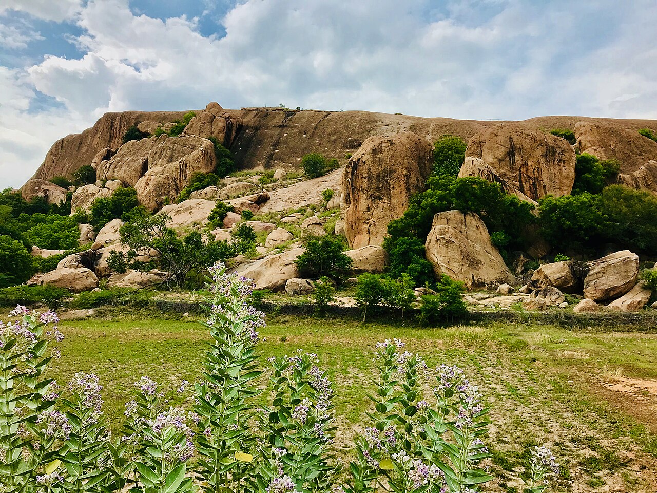
Samanar Hills
विरासत · 52 km · about 165 min by road
 #5 in Maduraiनिःशुल्क प्रवेश
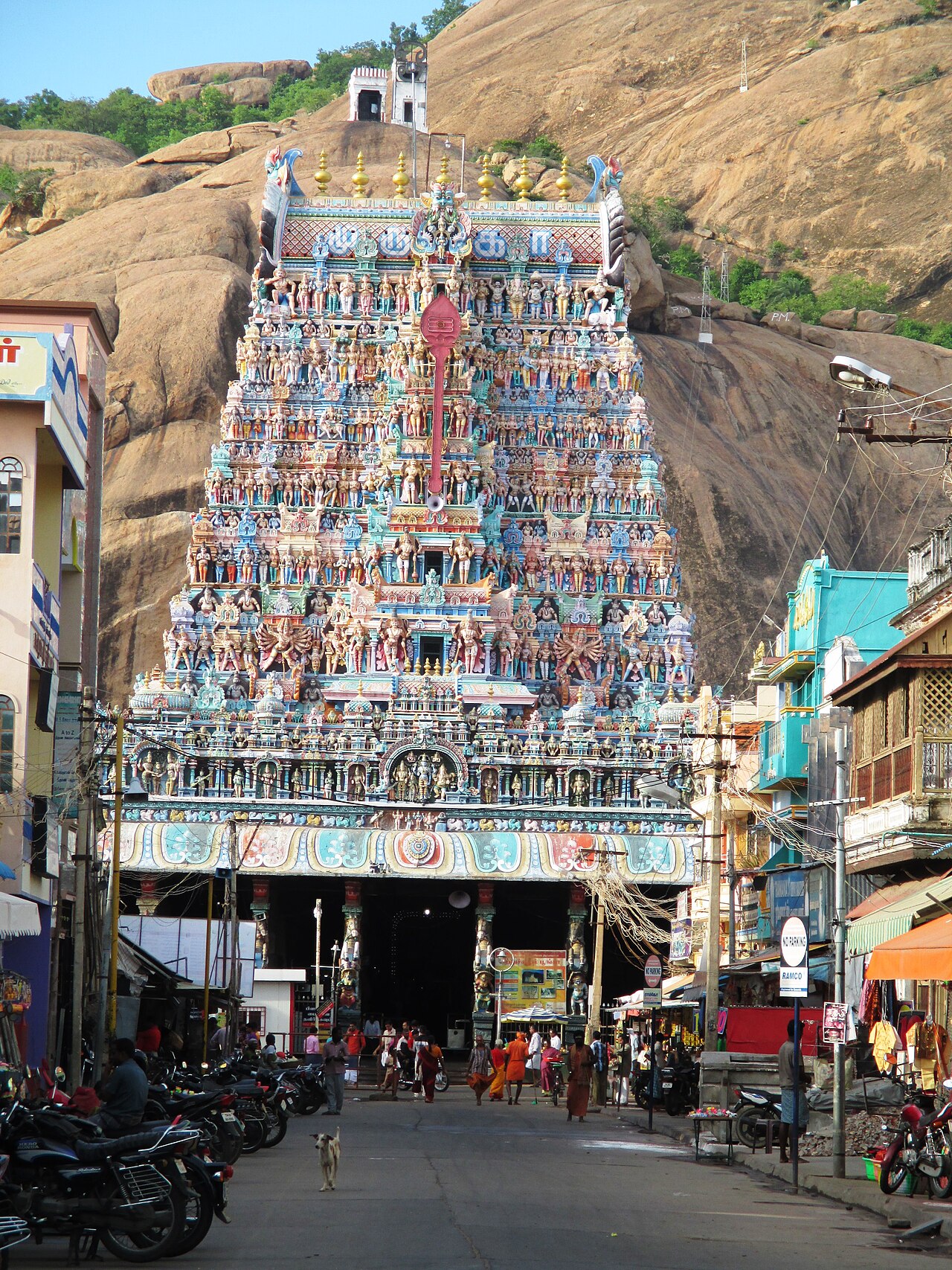
Thiruparankundram Murugan Temple
मंदिर · 56 km · about 175 min by road
 #7 in Maduraiनिःशुल्क प्रवेश
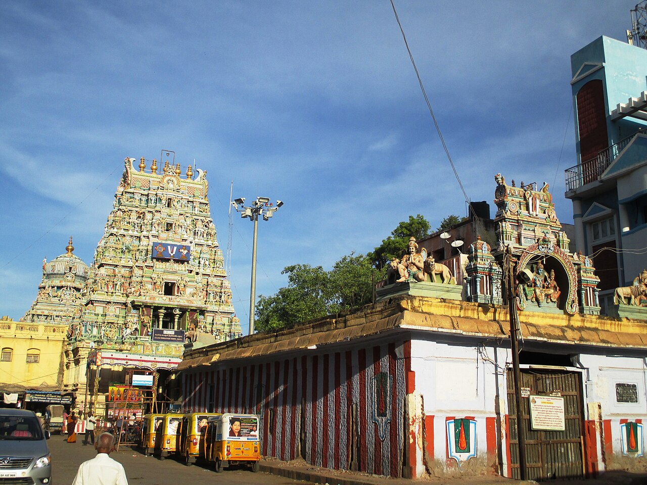
Koodal Azhagar Temple
मंदिर · 59 km · about 185 min by road
 #1 in Madurai
Meenakshi Amman Temple
मंदिर · 60 km · about 185 min by road