
Khardung La Pass
#6of 9 places to visit in LehLeh, Ladakh
Also known as Khardungla · Khardong La
Quick answer
Opening hours: No fixed opening hours. Entry is free. Allow 30 min. Best time: Mid-morning.
Updated · Compiled by Traveliac, AI-assisted · 5 min read
- Opening hours
- No fixed hours
- Accessible during daylight hours when open; the Border Roads Organisation does not enforce a fixed gate schedule but discourages lingering after dark due to ice, cold, and the absence of lighting.
- Entry fee
- Free
- Time needed
- 30 min
- Best time of day
- Mid-morning
- Best months
- Jun – Sep
- Address
- Khardung La, Leh District, Ladakh — on the Leh–Nubra road, approximately 40 km north of Leh.
About Khardung La Pass
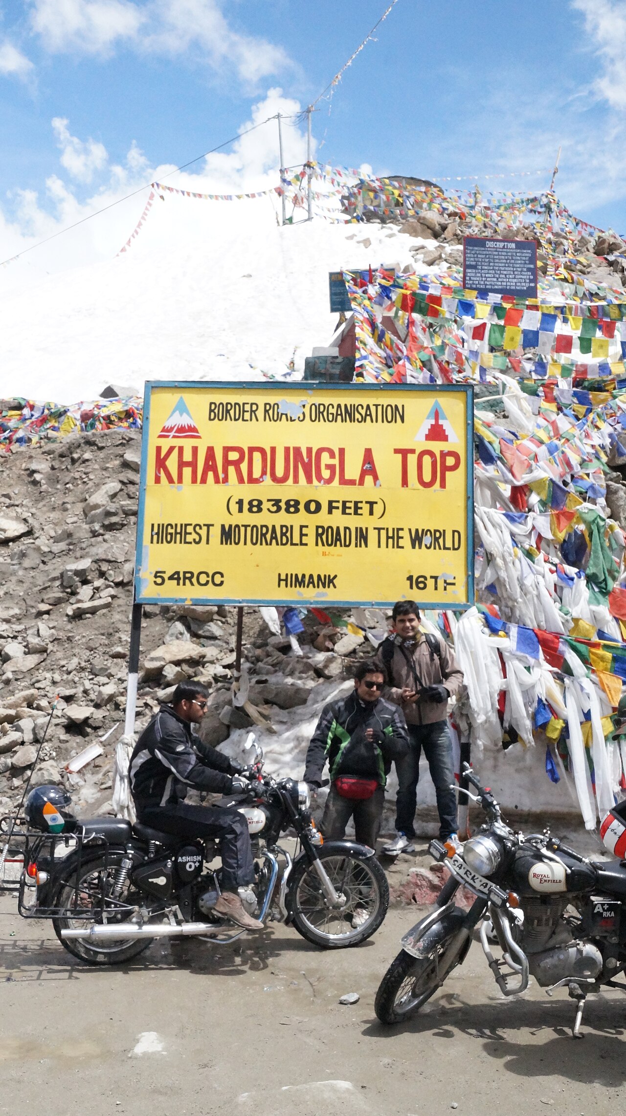
Khardung La carries the road from Leh over the Ladakh range into the Shyok and Nubra valleys, and for decades was marketed to visitors — on the summit signboard itself — as the highest motorable pass in the world at 5,602 metres. More precise GPS survey work in recent years has generally settled the pass's actual elevation closer to 5,359 metres, and its claim to the global superlative is, in any case, contested by several other Himalayan and Andean roads depending on how 'motorable' is defined; travellers should treat the 'highest in the world' claim as a piece of enduring signage folklore rather than a settled fact, without it diminishing the pass's genuine and considerable altitude. What is not in dispute is that this is among the highest paved roads accessible to ordinary tourist vehicles anywhere, and the physiological effects of that altitude are real regardless of which exact figure is correct. The summit itself offers a short, cold, exhilarating stop: a small shrine, a BRO-maintained signboard that is the obligatory photograph for every visitor, an army-run canteen serving tea and instant noodles, and views north toward the Karakoram range and south back down toward the Indus valley and Leh.
Best time of day: Mid-morning. 09:00–11:00, after the pass has had time to clear any overnight ice but before afternoon cloud buildup typical of high-altitude weather reduces visibility; avoid lingering at the summit for photography beyond 20–30 minutes given the altitude.
Khardung La Pass timings
- Opening hours
- No fixed hours
Mon–Sun No fixed hours - Accessible during daylight hours when open; the Border Roads Organisation does not enforce a fixed gate schedule but discourages lingering after dark due to ice, cold, and the absence of lighting.
- Closed on
- Open every day
Good to know: Officially maintained open May through October depending on snow clearance; can close temporarily even within this window after fresh snowfall, sometimes for a full day or more. Winter closure (November–April) is standard, and the pass should not be attempted outside the maintained season without direct confirmation from the BRO or local authorities.
Opening hours compiled from bro.gov.in and public records, last updated . They change without notice — confirm before you travel. How we write these guides
Khardung La Pass ticket price
| Ticket | Price |
|---|---|
| Indian visitors | Free |
| Foreign visitors | Free |
| Children | Free |
| Camera | Free |
No entry fee for the pass itself. Inner Line Permit is mandatory (checked at the North Pullu checkpost before the final ascent) since the pass is the access route to the restricted Nubra Valley zone. A café at the summit run by the Indian Army's welfare canteen sells hot drinks and instant noodles at modest, fixed prices.
Prices compiled from bro.gov.in and public records, last updated . They change without notice — confirm before you travel. How we write these guides
Best time to visit Khardung La Pass
- Quiet
- Moderate
- Very busy
08:00 – 10:00
Early departuresBest time to go
Vehicles that left Leh at dawn for Nubra Valley pass through. The summit parking area is uncongested and photography at the signboard is unhurried.
Quiet10:00 – 13:00
Peak convoy window
The busiest period, when the bulk of day-trip and Nubra-bound tourist traffic, motorcycle tour groups, and some military convoy vehicles converge at the summit simultaneously. Signboard photo queues form.
Very busy13:00 – 16:00
Afternoon return traffic
Vehicles returning from Nubra Valley to Leh pass through, along with some day-trippers heading the other direction. Afternoon cloud buildup can begin reducing visibility.
Moderate16:00 – 18:00
Late-day pass-through
Traffic thins as most vehicles aim to clear the pass before evening. Cold intensifies quickly once the sun drops behind the ridge.
Quiet
History of Khardung La Pass
The pass has been used as a trade and military route across the Ladakh range for centuries, historically forming part of the caravan network connecting Leh with Nubra Valley and onward, via the Karakoram Pass, toward Yarkand and Central Asia — the same Silk Route corridor that gave Nubra its Bactrian camel population. Its modern significance is primarily military and strategic: the road over Khardung La is the principal supply route to the Siachen Glacier region and other high-altitude Indian Army positions along the Line of Control and the disputed frontier with Pakistan, and the road's maintenance by the Border Roads Organisation reflects this priority as much as any tourism function.
The pass was opened to civilian vehicular traffic in 1976 and to general tourists in 1988, following the wider opening of Ladakh to independent travel. The 'world's highest motorable pass' claim, prominently displayed on the summit signboard for years, originated from early and since-revised elevation surveys; contemporary GPS measurement places the true elevation several hundred metres lower than the historic claim, a correction that has been reported in various travel and geographic publications over the past decade without yet fully displacing the older figure from local signage and popular memory.
Rules & etiquette at Khardung La Pass
Photography at the summit signboard and shrine is unrestricted, but avoid photographing any military vehicles, checkposts, or personnel along the route, including at the North Pullu checkpost where permits are verified — this is an active military supply corridor as well as a tourist road. Do not linger unnecessarily at the summit; BRO and army personnel may ask vehicles to keep the narrow parking area clear for through-traffic, particularly convoy vehicles.
Litter management at the summit is limited; carry out any waste rather than leaving it, in keeping with the broader no-plastic ethos enforced across restricted-zone checkpoints in Ladakh. If you feel unwell at the summit — dizziness, severe headache, difficulty breathing beyond mild breathlessness — inform your driver immediately and begin descent rather than waiting it out at altitude; the army canteen staff are generally able to assist with basic first aid but the appropriate response to worsening symptoms at 5,300m-plus is descent, not treatment in place.
Tips for visiting Khardung La Pass
- 1
Khardung La is not a destination to linger at — treat the 20-to-30-minute stop as the practical maximum given the altitude, and resist the temptation to walk around extensively for photographs; even fit, acclimatised visitors typically notice breathlessness on minimal exertion at this elevation. This is one of the highest points most tourists will reach anywhere in their lives, and the standard 48-hour Leh acclimatisation protocol applies with particular force here: attempting Khardung La on your first or second day in Ladakh, especially having flown directly into Leh from sea level, measurably raises your risk of acute mountain sickness symptoms including headache, nausea, and in rare but serious cases high-altitude pulmonary or cerebral oedema.
- 2
Most visitors experience Khardung La not as a dedicated outing but as the access route to Nubra Valley, which is the more logical way to think about the pass — plan it as the opening leg of a Nubra trip rather than a there-and-back day trip purely for the signboard photograph, since the latter yields a long, physiologically taxing round trip for a single stop. Carry warm layers regardless of season: even in July, wind chill at the summit is significant, and a light jacket adequate in Leh town is not sufficient here.
- 3
Confirm the pass is open before setting out — BRO closes it after fresh snowfall even within the official May–October season, sometimes with little advance notice, and your Leh guesthouse or taxi operator will generally know the current status from same-morning updates circulating among local drivers.
How to reach Khardung La Pass
The red star is Khardung La Pass; the numbered pins are the 2 nearest places in our guides, each showing its rank in its city. Tap a pin for details.
Khardung La, Leh District, Ladakh — on the Leh–Nubra road, approximately 40 km north of Leh.Directions in Google Maps
From Leh Main Bazaar
40 km · 75–100 min
Included within Nubra Valley taxi packages (₹5,500–₹8,500 one-way to Diskit/Hunder); a dedicated round-trip to the pass alone is uncommon and not recommended given the altitude exposure for minimal payoff
From Leh Main Bazaar
₹800–₹1,20040 km · 75–100 min
Per day rental, fuel extra; requires prior acclimatisation and cold-weather riding gear
From North Pullu checkpost
15 km · 25–35 min
Included in vehicle hire; ILP checked here before proceeding
Nearest airport
From Kushok Bakula Rimpochhe Airport (IXL), Leh
approximately 40 km, 1.5–2 hours by road.
Nearest railway station
From No railway connectivity to Ladakh as of 2026. Nearest railhead: Jammu Tawi (JAT), approximately 770 km by road.
Khardung La Pass FAQs
Is Khardung La really the highest motorable pass in the world?
This is a long-standing claim on the summit signboard, based on older elevation surveys placing it at 5,602 metres. More recent GPS measurement generally places the actual elevation closer to 5,359 metres, and the 'world's highest' title is contested by several other high-altitude roads depending on definition. Treat the claim as popular signage folklore rather than a settled geographic fact — the pass's genuine altitude and its physiological effects are real either way.
Do I need a permit to cross Khardung La?
Yes. Since the pass is the access route to the restricted Nubra Valley zone, an Inner Line Permit is required and checked at the North Pullu checkpost before the final ascent. Apply in advance via the LAHDC Leh ILP portal or the DC office, listing Nubra Valley and Khardung La together on the same application.
How long should I stay at the Khardung La summit?
20 to 30 minutes is the practical maximum for most visitors. At over 5,300 metres, even acclimatised travellers typically notice breathlessness on minimal exertion, and prolonged time at the summit increases the risk of altitude-related symptoms. Photograph the signboard, have a hot drink at the army canteen, and continue rather than lingering.
Can I visit Khardung La as a standalone day trip from Leh, or only en route to Nubra Valley?
It is technically possible as a there-and-back trip, but it is not the recommended approach — it means a long, physiologically taxing round trip purely for a summit photograph. Most visitors experience the pass as the opening leg of a Nubra Valley excursion, which makes better use of the altitude exposure and driving effort.
Compiled with AI assistance from official sources and public records, and published only after the checks in How we write these guides. Nobody from Traveliac has visited this place. Last updated . How we rank and check places
Places to visit near Khardung La Pass
Straight-line distances from our map; times are estimates.
 #5 in LehFree entry
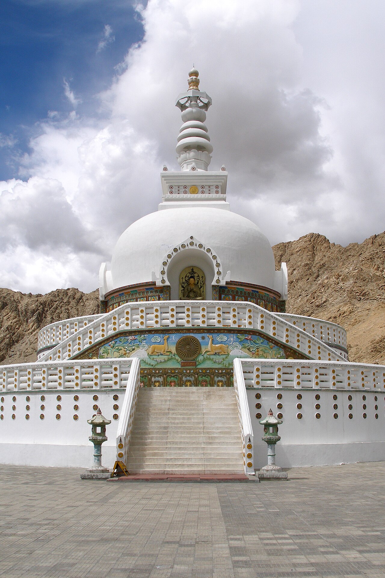
Shanti Stupa
Stupa · 12 km · about 35 min by road
 #3 in Leh
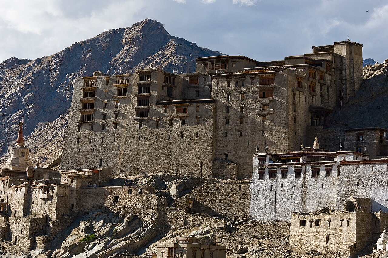
Leh Palace
Palace · 13 km · about 40 min by road
 #7 in Leh
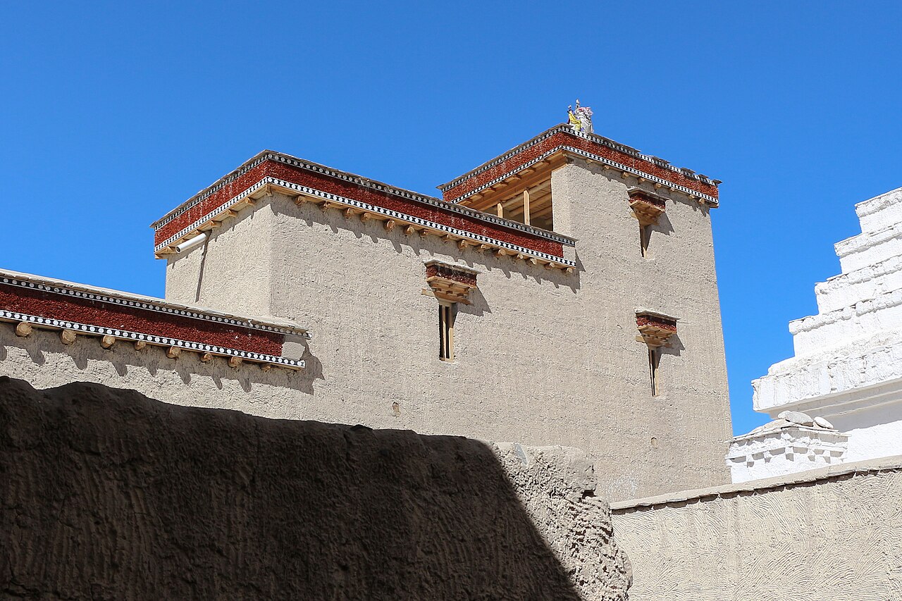
Shey Palace & Monastery
Monastery · 23 km · about 70 min by road
 #9 in LehFree entry
Magnetic Hill
Viewpoint · 26 km · about 80 min by road