
Pangong Tso
#1of 9 places to visit in LehLeh, Ladakh
Also known as Pangong Lake · Hollow Lake (from Tibetan 'Bang-Kong Tso')
Quick answer
Opening hours: No fixed opening hours. Entry is free. Allow 5 hrs. Best time: Late afternoon.
Updated · Compiled by Traveliac, AI-assisted · 6 min read
- Opening hours
- No fixed hours
- Accessible sunrise to sunset; there is no gate or closing time, but driving the Chang La route after dark is discouraged due to ice, altitude, and absence of lighting or mobile signal.
- Entry fee
- Free
- Time needed
- 5 hrs
- Best time of day
- Late afternoon
- Best months
- Jun – Sep
- Address
- Spangmik / Man / Merak villages, Pangong Tso, Leh District, Ladakh — approximately 160 km south-east of Leh via Chang La (5,360m).
About Pangong Tso
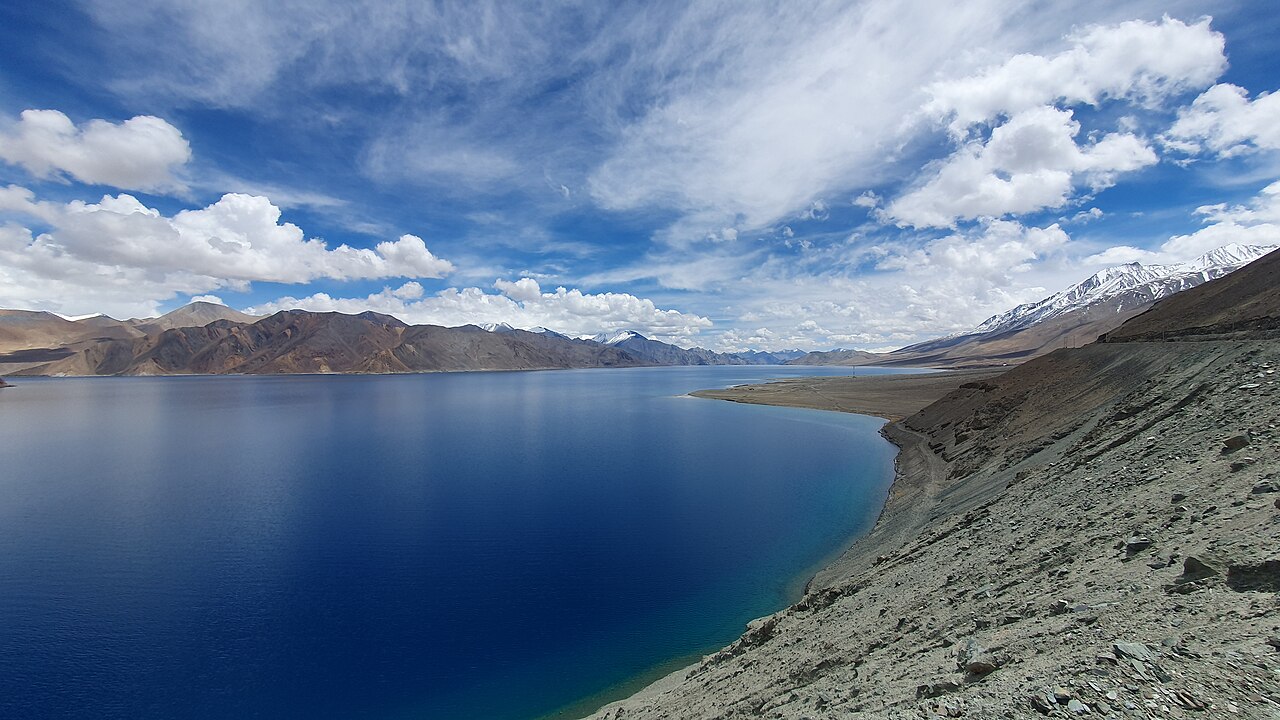
Pangong Tso extends 134 kilometres from Ladakh into Tibet's Rutog County, of which only the westernmost roughly 60 kilometres lie inside Indian-administered territory before the Line of Actual Control cuts across the water. The lake sits at 4,225 metres, a full 700 metres above Leh, and the drive there over Chang La — at 5,360 metres one of the higher motorable passes on the route network — is itself a significant part of the experience, not a preamble to it. The water is markedly saline despite the absence of any visible outflow, and its colour shifts across a range from deep indigo to turquoise to a pale jade depending on cloud cover, wind, and the sun's angle; the shift is fast enough that the same viewpoint photographed twenty minutes apart can look like two different lakes. The surrounding terrain is treeless high-altitude desert — bare scree slopes in ochre and grey rising directly from the shoreline, with the Chang Chenmo range visible to the north. The lake gained global visibility after a sequence from the 2009 film '3 Idiots' was shot at Pangong, and visitor numbers rose sharply in the years after. That popularity has not changed the fundamentals of the place: it remains remote, cold even in midsummer, and administratively sensitive given its position on a disputed and militarised frontier.
Best time of day: Late afternoon. 15:00–18:00 for the strongest colour shift across the water as the sun angle drops; sunrise for the stillest water and fewest vehicles, though the cold at 4,225m before 07:00 is severe even in July.
Pangong Tso timings
- Opening hours
- No fixed hours
Mon–Sun No fixed hours - Accessible sunrise to sunset; there is no gate or closing time, but driving the Chang La route after dark is discouraged due to ice, altitude, and absence of lighting or mobile signal.
- Closed on
- Open every day
Good to know: The lake partially freezes from December through February, and the Chang La access road is frequently closed by snowfall between November and April. The practical visiting window is May to early October. Even within season, Border Roads Organisation (BRO) can close Chang La for hours or a full day after fresh snowfall — always check road status in Leh the morning of departure rather than assuming the pass is open.
Opening hours compiled from leh.nic.in and public records, last updated . They change without notice — confirm before you travel. How we write these guides
Pangong Tso ticket price
| Ticket | Price |
|---|---|
| Indian visitors | Free |
| Foreign visitors | Free |
| Children | Free |
| Camera | Free |
The lake itself has no entry ticket. Inner Line Permit (ILP) is mandatory for both Indian and foreign nationals and is checked at the Chang La and Lukung checkposts — carry printed copies, not just phone screenshots, since signal is unreliable and checkpost staff sometimes require paper. A parking and environment fee of roughly ₹20–₹50 per vehicle is collected at Lukung village. Foreign nationals face additional restrictions: some stretches of the lakeshore beyond Spangmik and Man village are closed to foreign passport holders as they sit closer to the Line of Actual Control, and permits for foreigners are typically capped at a shorter validity window than for Indian nationals.
Prices compiled from leh.nic.in and public records, last updated . They change without notice — confirm before you travel. How we write these guides
Best time to visit Pangong Tso
- Quiet
- Busy
- Very busy
06:00 – 09:00
Overnight guests' sunriseBest time to go
Only travellers who stayed at Spangmik or Man guesthouses are present. Water is at its stillest, with minimal wind-driven surface texture and the clearest colour saturation.
Quiet11:00 – 15:00
Day-trip convoy peak
The bulk of same-day taxis and tour vehicles from Leh arrive in this window, having left before dawn. The main viewpoint near Spangmik and the '3 Idiots' photo spot become congested with parked vehicles and group photography.
Very busy15:00 – 18:00
Afternoon light shift
Day-trippers linger for the strongest colour transitions as the sun angle lowers. Some early arrivals begin the return drive over Chang La to reach Leh before dark.
Busy18:00 – 20:00
Evening departure window
Most day-trip vehicles have left for the Chang La return. Only overnight guests remain; temperatures drop sharply and the lake surface often turns a deep, near-black indigo before dusk.
Quiet
History of Pangong Tso
Pangong Tso has no single founding narrative in the way a monument does; its significance in Ladakhi life was pastoral and strategic rather than monumental. Nomadic Changpa herders grazed pashmina goats and yaks on the grasslands around Merak and Man villages for centuries, and the lake sat at the edge of trade and grazing routes connecting Ladakh with Rutog and western Tibet before the border hardened in the 20th century.
The modern political geography of the lake dates to the 1962 Sino-Indian War, after which the Line of Actual Control bisected the lake roughly two-thirds of the way along its length, leaving India with the shorter western portion. The lake has periodically featured in India-China border tensions since, including a significant military standoff along its northern and southern banks in 2020, which resulted in a mutual disengagement agreement in early 2021. This history is precisely why the Inner Line Permit regime exists here: the area is a functioning military frontier as well as a tourist destination, and the two functions coexist under close administrative supervision rather than by informal arrangement.
Spangmik, the village most visitors treat as their base, and Man and Merak further along the southern shore, remain small Changpa settlements whose economy has shifted substantially toward homestays and parking-fee tourism over the past fifteen years, alongside continued pastoralism.
Rules & etiquette at Pangong Tso
Apply for the Inner Line Permit online through the Ladakh Autonomous Hill Development Council's ILP portal, or in person at the DC office in Leh, before travelling — same-day processing is common but not guaranteed during peak July–August season when volumes are high. You will need passport-size photographs (carry at least four spares; requirements vary by counter) and a photocopy of your identity document; foreign nationals need their passport and Indian visa details and should expect a shorter permit validity and, in some cases, an escort requirement for certain routes near the LAC — confirm current foreign-national restrictions with your travel agent or the DC office directly, as these change without much public notice.
Stay on marked approach paths to the shoreline; the lakebed silt is soft in places and vehicles have become stuck attempting to drive directly onto the beach. Photography of any military installation, checkpost, or personnel along the route — including at Chang La and the Lukung checkpost — is prohibited; keep cameras and phones down while passing through these points. Camping is permitted only at designated sites in Spangmik, Man, and Merak; wild camping directly on the open shoreline is discouraged by the local village councils and, in restricted stretches nearer the LAC, is not permitted at all.
Carry out all litter — there is no waste collection infrastructure at the lake, and the current 'no plastic' enforcement by LAHDC includes checks at the Lukung gate.
Tips for visiting Pangong Tso
- 1
Altitude is the dominant planning constraint here, not distance. At 4,225 metres — and having just crossed a 5,360-metre pass to get there — visitors who have not completed at least 48 hours of acclimatisation in Leh are at meaningfully elevated risk of acute mountain sickness: headache, nausea, breathlessness, and disturbed sleep are common even in acclimatised visitors and can progress to more serious high-altitude pulmonary or cerebral oedema in rare cases. Carry acetazolamide (Diamox) if prescribed in advance by your doctor, descend immediately if symptoms worsen rather than push through, and avoid alcohol the night before and during the visit.
- 2
Most Leh travel agencies sell this as a long day trip (leave 05:00–06:00, return by 20:00–21:00) or as an overnight at a Spangmik guesthouse — the overnight option is strongly preferable if your itinerary allows it, both for the sunrise-to-sunset colour range and because it halves the single-day driving fatigue at altitude. Fuel up completely in Leh; there are no reliable fuel stations between Leh and the lake, and the return journey over Chang La in the evening should not be attempted on a low tank.
- 3
Mobile network coverage is essentially absent for the entire Chang La–Pangong corridor except for a BSNL/Airtel signal directly at Spangmik village — inform family of your itinerary before departing and do not rely on being reachable en route. Warm layers are essential regardless of season: even in July, wind chill at the lakeshore after sunset drops well below what the daytime temperature suggests. If travelling in a private taxi rather than a shared one, confirm your driver carries a portable oxygen cylinder and a basic first-aid kit, which most registered Leh taxi union vehicles do as standard.
How to reach Pangong Tso
The red star is Pangong Tso. Tap a pin for details.
Spangmik / Man / Merak villages, Pangong Tso, Leh District, Ladakh — approximately 160 km south-east of Leh via Chang La (5,360m).Directions in Google Maps
From Leh Main Bazaar
₹6,500–₹9,500160 km · 270–330 min
Return per vehicle (day trip); overnight packages with a Spangmik stay typically run ₹8,000–₹12,000 inclusive of driver charges
From Leh Main Bazaar
₹1,500–₹2,500160 km · 270–330 min
Per seat, day-trip basis, subject to minimum group size
From Kushok Bakula Rimpochhe Airport (IXL)
₹9,000–₹13,000165 km · 280–340 min
— strongly discouraged directly off a flight; complete acclimatisation in Leh first
Nearest airport
From Kushok Bakula Rimpochhe Airport (IXL), Leh
approximately 160 km, 4.5–5.5 hours by road.
Nearest railway station
From No railway connectivity to Ladakh as of 2026. Nearest railhead: Jammu Tawi (JAT), roughly 860 km by road from the lake.
Pangong Tso FAQs
Do I need a permit to visit Pangong Tso, and how do I get one?
Yes, an Inner Line Permit is mandatory for all visitors, Indian and foreign. Apply online via the LAHDC Leh ILP portal or in person at the Deputy Commissioner's office in Leh's Main Bazaar area. Bring passport-size photographs and an identity document photocopy. Same-day issuance is common outside peak season but can take longer in July–August. Foreign nationals should confirm current validity periods and any restricted stretches directly with the DC office or their travel agent, as rules near the Line of Actual Control are updated periodically.
Is Pangong Tso safe to visit given the altitude?
The lake sits at 4,225 metres and the access road crosses Chang La at 5,360 metres, both significantly higher than Leh (3,524m). Complete a minimum of 48 hours of acclimatisation in Leh before attempting the trip. Watch for headache, nausea, and breathlessness; descend immediately if symptoms worsen. Carry any altitude medication prescribed by your doctor in advance, and confirm your taxi carries emergency oxygen, which is standard for registered Leh Taxi Union vehicles.
Is it better to visit Pangong Tso as a day trip or stay overnight?
An overnight stay at a Spangmik, Man, or Merak guesthouse is preferable when time allows. It halves the single-day driving fatigue at altitude, and gives access to both sunrise and sunset light on the water rather than only the compressed midday-to-afternoon window a day trip allows. Guesthouses are basic — expect limited hot water and no reliable heating beyond a bukhari stove — but are registered and inspected by the local village council.
Why is only part of Pangong Tso in India?
The lake extends 134 kilometres in total, but the Line of Actual Control established after the 1962 Sino-Indian War cuts across it roughly two-thirds of the way along its length, leaving India the shorter western portion of around 60 kilometres. The lake has been the site of periodic India-China border tension, including a 2020 military standoff, which is why photography of military installations and checkposts along the route is strictly prohibited.
Compiled with AI assistance from official sources and public records, and published only after the checks in How we write these guides. Nobody from Traveliac has visited this place. Last updated . How we rank and check places
Places to visit near Pangong Tso
Straight-line distances from our map; times are estimates.
 #4 in Leh
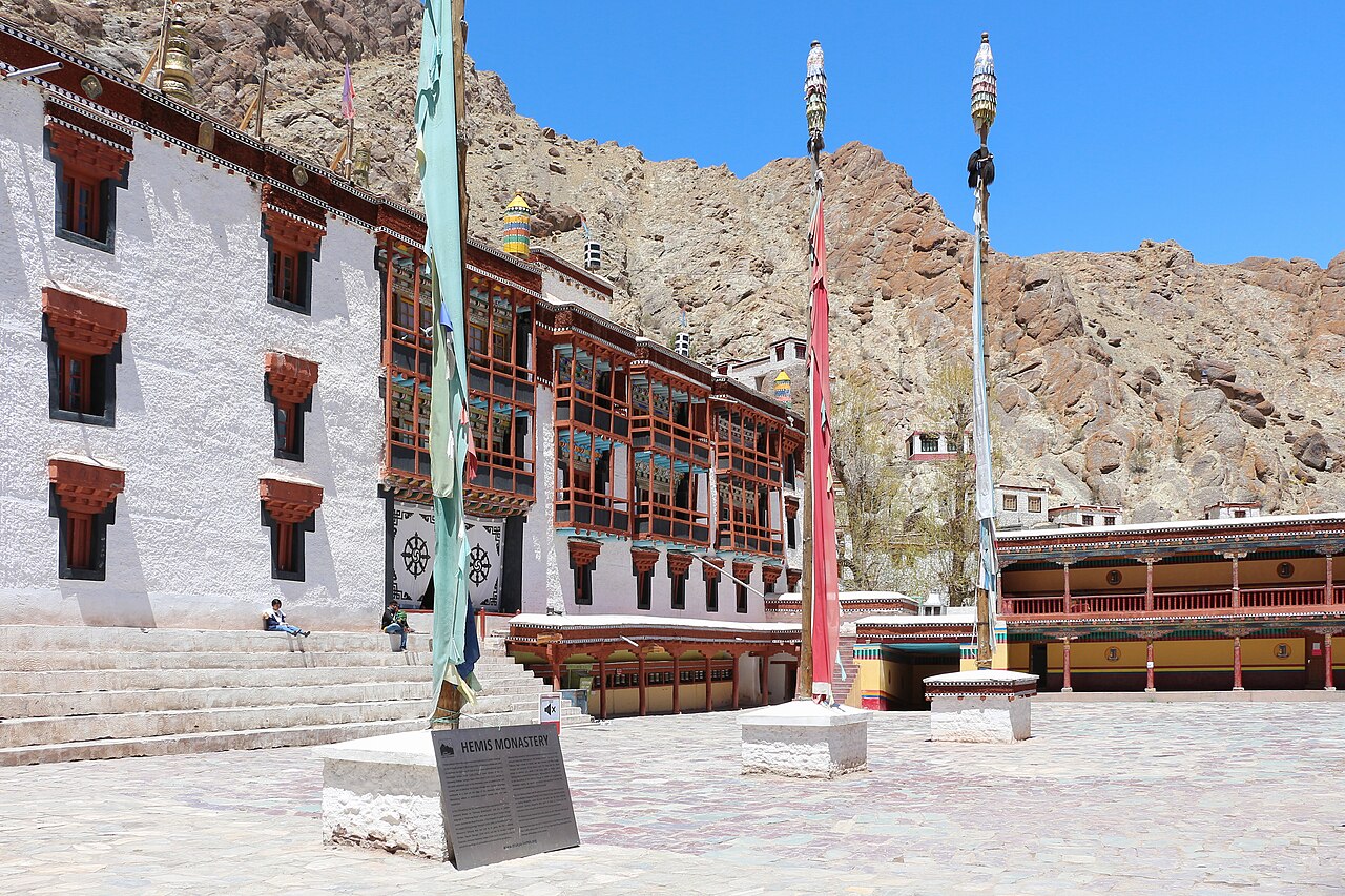
Hemis Monastery
Monastery · 68 km · about 210 min by road
 #7 in Leh
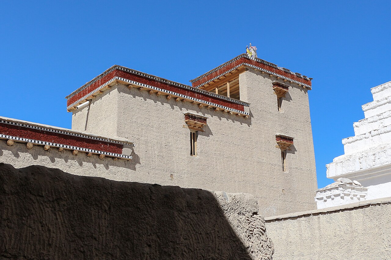
Shey Palace & Monastery
Monastery · 75 km · about 235 min by road
 #3 in Leh
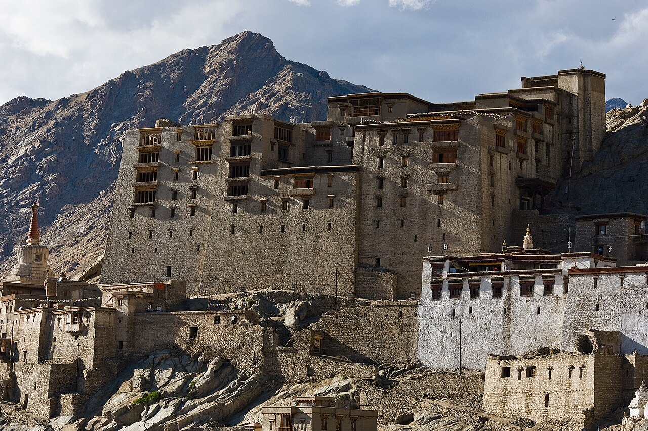
Leh Palace
Palace · 82 km · about 255 min by road
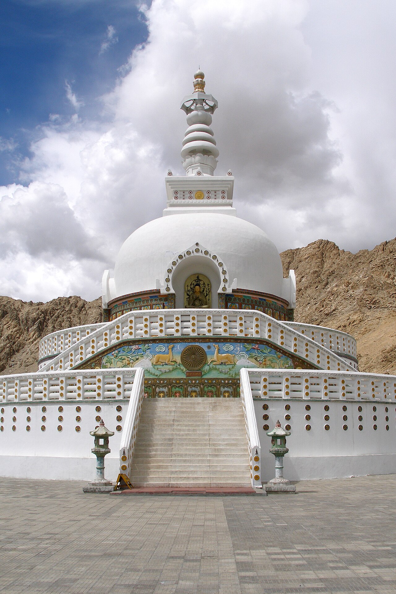 #5 in LehFree entry
Shanti Stupa
Stupa · 83 km · about 260 min by road